By Terry Witt -Spotlight Senior Reporter
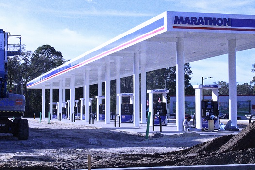
One of the largest commercial projects in Bronson’s history is nearing completion at the city’s main traffic light, and while there’s little doubt the Jiffy Store-Hardees gas plaza will be financially successful, the unknown question is how drainage might be impacted by the development.
The three main features of the commercial area are a Jiffy Store, Hardees Restaurant, and a package store selling alcoholic beverages. All three commercial outlets will stand behind a row of eight or nine gasoline pumps fronting U.S. 27A and State Road 24.
Owner Stoney Smith, who heads up the project for Hudson Foods in Chiefland, said the company had hoped to open for business in late January but has pushed back the opening to the first week of February. The eventual plan is to open the facility around the clock, seven days a week.
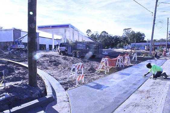
The Suwannee River Water Management District has approved the stormwater drainage system designed by engineer Andrew Carswell with the key feature of the system being a drainage retention pond at the back of the commercial area more than 120 yards long and 50 yards wide with tall earthen banks on all sides.
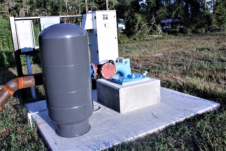
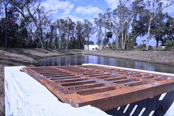
Carswell designed the drainage pond with a concrete overflow structure on the south end covered by a metal grate that is intended to capture any excess stormwater before it reaches the rim of the giant pond and sends it through a concrete outfall culvert to a low-lying hardwood forest on the west side.
The engineer has also designed an 18-foot-wide back street for two-way traffic that empties into the commercial area on the north end and Main Street on the south end.
“We feel the locals will use the back street that connects to SR 24 and 27 for the highway folks,” Smith said.
Many local residents say the area where the back street and drainage retention area are constructed were often wet during heavy rains before the site was developed. There is concern that when the low-lying woods are filled with water, any overflow from the massive pond could result in flooding, but there is no scientific evidence to support those claims. Locals who have lived here a long time feel that flooding is a real possibility.
“I think only time will tell if it impacts drainage in that area during heavy storms,” Smith said.
Carswell said the area where the drainage retention pond and adjoining back street are constructed is uplands. An ecologist hired by Hudson Foods who studied the area didn’t find any wetlands nor was he able to determine where a wetlands line might be located.
“We stayed out of the flood-prone area. There’s a little bit right in the corner where it makes the U-shape behind the commercial buildings that we had to compensate for,” Carswell said. “We had to dig some more dirt out of the retention area part to fill in.”
Carswell said the commercial area is elevated along State Road 24 and U.S. 27A to push stormwater to the big drainage retention pond.
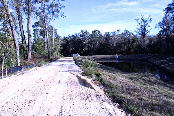
“It’s a flood-prone area behind him there and to get the retention area to work we had to build the site up to get the water to it,” Carswell said.
Carswell said the area of the drainage retention pond and adjoining back street were naturally sloped downward away from Julie’s Diner, the adjoining motel, and Charlie’s Pub, as well as Weeks Marathon before the site was developed.
“I don’t want nobody to complain,” Carswell said. “I haven’t flooded nobody, so I guess we’re doing alright so far.”
The one-inch rain that fell Sunday night in Bronson barely put a dent in the holding capacity of the drainage retention pond, but the weather in the past 2 ½ months has been relatively dry and the pond didn’t contain much stormwater before the rain event.
Most of Bronson’s business district is built on a sand ridge along the edge of swamp or low-lying forest land. The South Bronson Ditch, named by the Federal Emergency Management District, passes within 100 feet of the new drainage retention pond behind Capital City Bank on the south side of Main Street. Locals say Main Street has never flooded and the ditch is the reason why.
The South Bronson Ditch was constructed by the Civilian Conservation Corps in the 1930s. It was part of the effort to put unemployed men back to work during and immediately after the Great Depression. The South Bronson Ditch has been designated by FEMA on recently revised flood elevation maps as a “regulatory floodway.”
Building in a regulatory floodway or obstructing it isn’t legal under federal regulations unless the obstruction doesn’t increase flood levels. There is one manmade obstruction in the ditch. A landowner filled the ditch with dirt to create a cattle-crossing years ago. Some say the earthen cattle crossing is within the Bronson city limits.
The ditch hasn’t been maintained by the Levy County Commission since the 1980s or early ‘90s. The ditch has begun to fill in with fallen trees and mud in some areas over the passage of time, but the worst of the obstructions is the manmade cattle crossing that completely blocks the ditch.
The Hudson Foods project doesn’t block the ditch, but there is concern among some members of the Bronson community that stormwater from the project could cause the ditch to overflow during high water events.
The south entrance to James H. Cobb Park, Bronson’s recreational Park, is two-tenths of a mile from the Hudson Foods drainage retention area. The park was carved out of swamp and low-lying woodlands known as the flatwoods and large portions of the park flood every year during heavy rains.
Some locals believe the manmade cattle crossing blocking the ditch is obstructing drainage from the park, although there has never been a scientific study to determine whether that is the case. The park naturally floods during heavy rains. Whether it floods more because of the obstruction in the ditch is possible, but largely speculative.
The drainage study for the Hudson Foods project approved by the water management district may not have factored in obstructions in the ditch, whether manmade or natural, and how those obstructions could influence how effectively the Hudson Foods project drains during heavy rains or whether flooding could occur. Spotlight was unable to interview permitting specialists at the water district. They did not return calls.
It is a certainty that the massive drainage pond designed by Carswell will hold a considerable amount of stormwater runoff from the commercial buildings and pavement of the Hudson Foods project, and it’s also a certainty the overflow will get channeled into the flatwoods along the pond. But the one unknown factor is how obstructions in the ditch might alter drainage calculations for the surrounding neighborhoods. The ditch along Bronson’s west side has traditionally kept Bronson bone dry during heavy storm events. Old-timers who have long since passed away said they never saw Bronson flood after the ditch was constructed.
During Hurricane Elena in 1985, the Inglis Dam reportedly recorded two feet of rainfall 30 miles south of Bronson. Neither the Town of Bronson nor the Levy County Commission kept official rainfall totals that year, but what is known is that the rainfall was so heavy between Bronson and Chiefland that the stormwater created two continuous linear lakes in both ditches of U.S. 27A from Bronson to Chiefland at the height of the storm. The highway had two lanes of traffic at the time. The stormwater filled the ditches to the edge of the pavement along that 12-mile stretch of highway, and yet Bronson remained dry, probably thanks to the South Bronson Ditch. This reporter drove from Bronson to Chiefland and witnessed the two linear lakes that formed in the ditches during the storm. The highway was carpeted with millions of recently hatched frogs, making the pavement slippery in the high winds.
——————
Enterprise Reporting by Terry Witt January 16, 2022; Posted January 16, 2022


