County Commissioner Rock Meeks said the state hasn’t told him about any potential routes for the toll road. He sits on the Northern Turnpike Corridor Task Force.
By Terry Witt – Spotlight Senior Reporter
One of the great mysteries in Levy County isn’t where pirate’s gold is allegedly buried somewhere in Fowlers Bluff. Everyone knows it’s there, right? It’s somewhere, but no one has ever found it.
Yep. Moving right along…
In reality, the greatest modern mystery in Levy County isn’t the location of pirate’s gold, but rather it’s the future location of a toll road that might be built through the county, or may never get built.
It just depends.
Some people hope the State of Florida shoots itself in the foot with bad publicity, poor communications, and clumsy planning and never builds it but others haven’t totally given up hope of seeing something of substance emerge.
An entire team of state officials representing the Northern Turnpike Connector Task Force attended the Sept. 8 Levy County Commission meeting to unravel some of the unanswered questions about the potential southern end of the toll road project through Levy County.
Jeff Arms, a program manager for the Northern Turnpike Connector Task Force study said the state is aware Levy County residents and their elected officials want to see a line on the map showing the actual route of the toll road. He said the state hasn’t selected a route for the road. The toll road planning process is in the first phase and the various alignments (possible routes) won’t be announced until the completion of the Project, Development and Engineering (PD&E) phase. The PD&E starts in early to mid-2021.
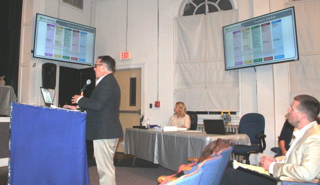
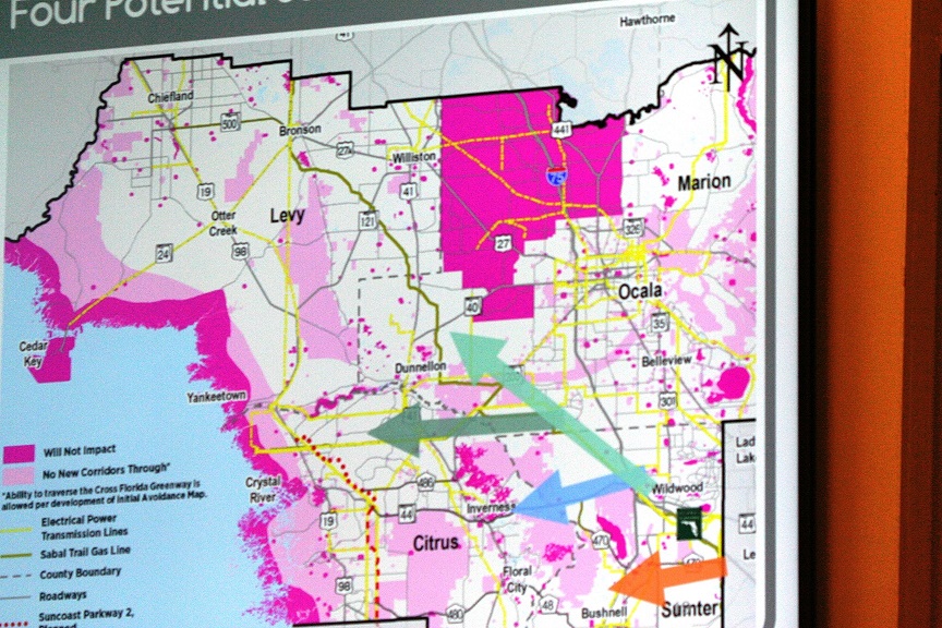
Arms projected a color map on an overhead screen for commissioners. The map showed “avoidance and attraction” areas for the toll road. It looked like digital abstract art. Areas in Levy County off-limits to toll road construction were painted on the map in magenta, a blend of red and blue colors. Areas in light pink, including Goethe State Forest, were off-limits to “new corridors” through the forest. While it is true that existing county roads pass through the forest, state officials said the guiding principles developed by the task force would likely prohibit any type of construction in the forest itself. However, they said there are opportunities to build the toll road on the east or west side of the forest based on the guiding principles.
“There’s been a lot of discussion – want to see a line on the map – this isn’t exactly a line on the map but at least it gives you some discussion how we can start going about developing lines on the map so to speak,” Arms said.
Arms said two task force groups are working on gathering information for the proposed toll road. The Suncoast Connector Task Force and the Northern Turnpike Connector Task Force will finish their work and turn in a report to Gov. Ron DeSantis on Nov. 15.
The Northern Turnpike Connector must connect with the Suncoast Connector.
The ultimate aim of the PD&E is to propose alternative routes for the toll road and compare them against the no-build alternative.
“We’re two steps before that, so I know that’s led to some of the frustration of, if you know, we want to see a line on the map. Where are we going?” he said. “With the process we have, a task force was laid out of subject-matter experts including elected officials is to be engaged as well. We have a lot of different representatives from environmental groups as well as the level of elected officials. So it’s supposed to be a real cross-section of interests and needs and so we can kind of look holistically at this process.”
County Commissioner Rock Meeks, who represents Levy County on the Northern Turnpike Connector Task Force said if the state knows the future route of the road he hasn’t been told about it. County Commission Chairman Matt Brooks represents Levy County on the Suncoast Connector task force. He said the Suncoast Connector Task Force study has identified two broad “swaths” through the county that are potential areas where the toll road could be constructed, one near Bronson and the other along U.S. 19. But the swaths aren’t actually toll road routes. They are broad corridors.
Regarding lines on a map, state officials representing the Suncoast Connector Task Force made an appearance at a Chiefland City Commission meeting and revealed a co-location map with lines showing the Suncoast Connector potentially running north along U.S. 19 through Levy County to the north Jefferson border or possibly branching off U.S. 19 in Old Town and running east to U.S. 27A and then north. It was actually a map with lines. Fancy that.
The Northern Turnpike Connector Task Force study area includes Levy, Citrus, Madison, and Sumter counties. The Northern Turnpike Connector would be 40 miles long and extend west from the northern tip of the existing state turnpike to the Suncoast Parkway toll road in Citrus County. The toll road would likely extend northward from Citrus County through Levy County to Jefferson County and Madison counties.
The Suncoast Connector Task Force study area covers Citrus, Dixie, Levy, Gilchrist, Jefferson, Lafayette, and Madison counties.
Levy County is part of both study areas.
The state planning process describes future toll roads as Multi-Use Corridors of Regional Economic Significance or M-Cores. The M-Cores toll roads are intended to “revitalize rural communities, encourage job creation, promote regional connectivity while leveraging technology, enhanced quality of life and public safety and protecting the environment and natural resources.”
It’s a mouthful.
Many Levy County residents are wondering whether the two task force studies are just the tip of a proverbial iceberg sticking out of the water. What lies beneath the surface is what they can’t see, and that’s what worries them.
——————-
Board of County Commission Regular Meeting September 8, 2020; Posted September 19, 2020