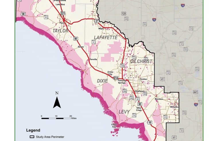
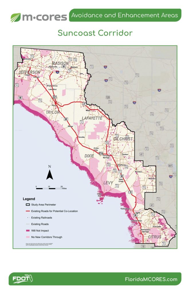
The map shows areas that will be avoided in pink. The red-marked highways could serve sites for the co-location of toll roads.
By Terry Witt – Spotlight Senior Reporter
Florida Department of Transportation officials Monday didn’t unravel the mystery of where the agency might build the future Suncoast Connector toll road in Levy County, but they said the Suncoast Connector Task Force will wield considerable influence on choosing a route.
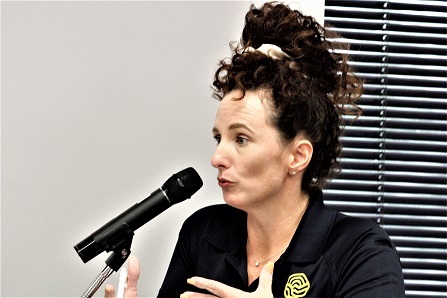
DOT official Brandi Bertram told Chiefland City Commissioners they will also play an important role in giving the agency guidance on whether the toll road should pass through Chiefland, go around it as a bypass road, or not come near the city. The city commission has yet to take a public position on the issue.

Based on Bertram’s comments, City Manager Mary Ellzey suggested the city commission discuss the issue at a future board meeting and come to an agreement on where the board thinks the toll road should be constructed. The city would pass the information along to DOT.
DOT officials have attended every city commission meeting for several months and given updates on how the agency is working with task force officials and local communities to figure out the best route for the toll road. County Commissioner Matt Brooks of Williston is a member of the Suncoast Connector Task Force, a 41-member board.
The Northern Turnpike Connector Task Force is working with communities to determine the best route for a toll road that would extend from the existing Florida Turnpike at Wildwood to western Levy County and possibly U.S. 19. County Commissioner Rock Meeks of Chiefland sits on that 39-member board.
DOT is showing interest in the concept of building a toll road alongside an existing free highway. The construction of a toll road along a free highway is known as co-location.
DOT consultant Andrea Garcia passed out a map identifying roads that were potential sites for co-location of a toll road alongside an existing free highway in the Suncoast Corridor. The highways were marked in red. There were two potential routes shown.
One route showed U.S. 19 marked in red from Citrus County north to Fanning Springs. The red line then takes a right and follows State Road 349 in Dixie County north through Lafayette County to Perry and ending in Madison County.

The second route, like the first one, begins on U.S. 19 in Citrus County but continues on U.S. 19 through Chiefland, Fanning Springs, Cross City, Taylor County and into Jefferson County.
Bertram was asked if the Williston and Bronson areas were being excluded as possible sites for co-locating a toll road along an existing highway since there are no red-line highways passing through Bronson and Williston on the “avoidance and enhancement areas” map. She said no areas have been excluded from consideration.
In 2016 the DOT proposed converting U.S. 41 through Williston to a future toll road but the agency was greeted with considerable opposition from residents. Bronson hasn’t been friendly to the idea of a toll road passing near or through that town.
Chiefland has been relatively quiet thus far. The city commission appeared to be waiting for DOT to declare a future route and then react to it, but Bertram said DOT is waiting for the city’s input. She said the agency greatly values the city’s input. DOT will use information gleaned from task force meetings, city commission meetings, DOT open houses and public comments on its website to figure out the best route for the two toll roads.
The two proposed toll roads are known as Multi-Use Corridors of Regional Economic Significance (M-CORES). The Florida Legislature last year directed DOT to begin planning for the toll roads. DOT has been ordered to bring the governor recommendations by October this year.
Bertram would give no assurance that route maps would be ready for public comment before October. She said DOT is developing information that results in proposed routes after gathering as much public input as possible.
The state has developed the avoidance and enhancement areas map for the Suncoast Corridor. The map, attached to this story, shows the areas that won’t be impacted by the toll roads in red. The map shows areas that will be avoided in pink. The red-marked highways could serve sites for co-location of toll roads. This is the link to FDOT website link to the map: https://fdotwww.blob.core.windows.net/sitefinity/docs/default-source/info/co/news/newsreleases/03062020-suncoast-avoidance_and_enhancement.pdf?sfvrsn=dfea2900_2
———————-
City of Chiefland Regular Meeting March 9, 2020; Posted March 9, 2020
