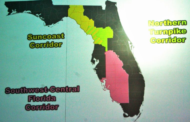
Florida Department of Transportation has produced this map showing the three study areas for proposed toll roads in western Florida. The color code shows the Southwest Corridor, Northern Turnpike Corridor and Suncoast Corridor study areas. The slanted lines show Levy and Citrus potentially are the sites of the Suncoast and Northern Turnpike Corridors. Detailed maps showing proposed routes haven’t been developed, according DOT. This map was part of a slide presentation at an open house at the College of Central Florida. Photo by Terry Witt:
Below is Information From: FDOT Florida M-CORES Calendar of Events Website https://floridamcores.com/calendar-of-events/
January 28, 2020
